
Hammonds Plains-Lucasville
Riding (Provincial Electoral District) Overview
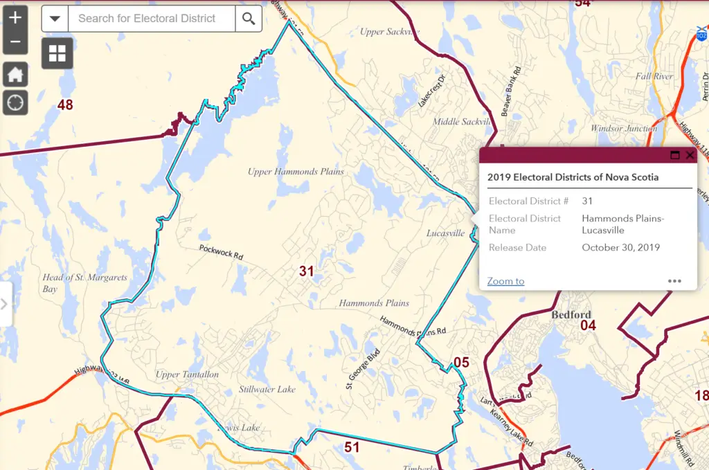
Hammonds Plains‑Lucasville is a provincial electoral district in Nova Scotia, created in 2012. It covers 169 km² west of downtown Halifax and is represented by Rick Burns (PC) in the Nova Scotia House of Assembly
Communities in Hammonds Plains‑Lucasville Riding
The Hammonds Plains‑Lucasville riding encompasses its namesake communities of Hammonds Plains and Lucasville and a mix of vibrant lakeside and parkland neighbourhoods. This vibrant district combines scenic waterways, winding trails and close proximity to Halifax’s urban centre, creating an ideal setting for families and outdoor enthusiasts
Hammonds Plains
A historic and growing suburban area known for large wooded lots, lakes, and family-friendly subdivisions.
Lucasville
Area Map
Indigo Shores
Indigo Shores is a lakeside subdivision situated in Middle Sackville, just north of McCabe Lake. Offering community access to the lake and extensive parkland trails, it’s conveniently located off Highway 101 (Exit 2A)—minutes from Bedford Commons and Burnside, and roughly 25 minutes to downtown Halifax
Brookline Park (West Bedford)
Brookline Park, part of The Parks of West Bedford, blends modern urban design with a suburban atmosphere. Located near Larry Uteck Boulevard, this growing community offers walkable access to shops, new schools, green space, and quick highway connections, all in a planned neighbourhood of tree-lined streets, cul-de-sacs, and contemporary homes.
Westwood Hills (in Upper Tantallon)
Area Map
Haliburton Hills (in Stillwater Lake)
A quiet, scenic community with winding roads and a strong sense of neighbourhood pride.
Area Map
Highland Park
A mature subdivision surrounded by nature, with trails, parks, and access to nearby schools and services.
Area Map
Yankeetown
A small, historic rural community known for its open spaces and agricultural roots.
Upper Hammonds Plains
Upper Hammonds Plains was established in 1815 as a settlement for Black Refugees from the War of 1812. These individuals sought freedom and a fresh start in Nova Scotia. The community is one of the earliest African Nova Scotian settlements and has a rich history of resilience and cultural heritage
Perry Pond
Area Map
White Hills
White Hills, a residential community blending established homes and newer developments, with access to natural trails
Area Map
Maplewood
A family-oriented neighbourhood with a mix of single-family homes and green spaces.
Area Map
Glen Arbour
Glen Arbour, a well-known golf course community featuring upscale homes, lakes, and manicured green space.
Area Map
Uplands Park
A mature neighbourhood with spacious lots and established landscaping, near community facilities.
Area Map
Voyaguer Lakes
A private residential community built around a series of man-made lakes, emphasizing outdoor living.
Kingswood
Area Map
Kingswood North
An extension of Kingswood, offering newer homes with access to local parks and schools.
Area Map
Blue Mountain Estates
A small, peaceful subdivision surrounded by natural forest and walking trails.
Waterstone
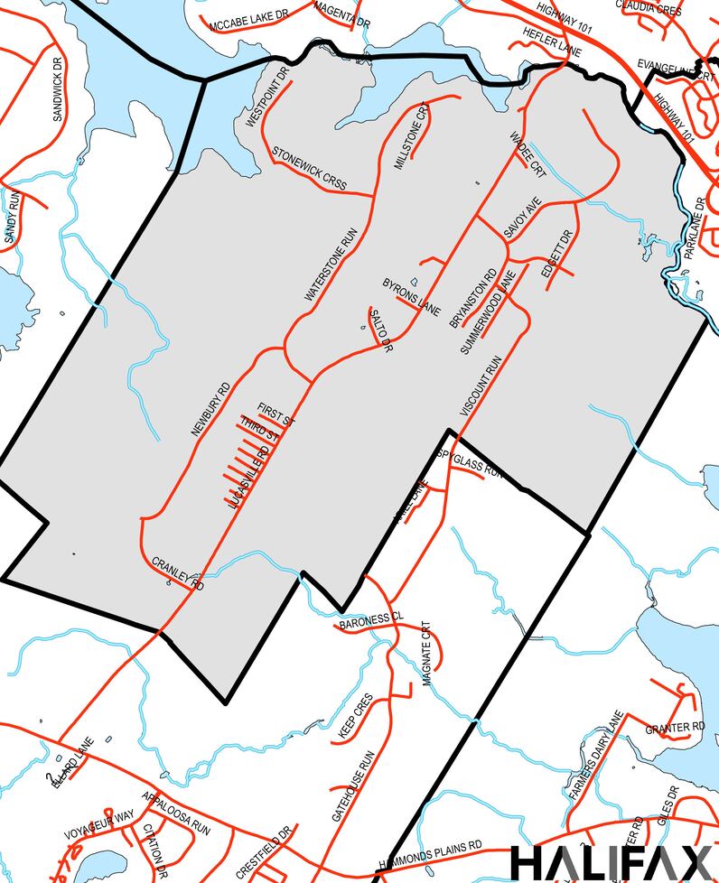
Waterstone is a modern residential subdivision within the Lucasville community, featuring newer single-family homes. It reflects recent boundary adjustments that clarified the area’s historic limits.
Add Your Heading Text Here
Lorem ipsum dolor sit amet, consectetur adipiscing elit. Ut elit tellus, luctus nec ullamcorper mattis, pulvinar dapibus leo.
Geographic Boundaries
Land area is 169 km².
Borders are as follows:
• North: Sackville‑Cobequid
• East: Clayton Park West and Bedford South
• South: Timberlea‑Prospect
• West: Chester‑St. Margaret’s (Upper Tantallon north of Hwy 103)
Add Your Heading Text Here
Lorem ipsum dolor sit amet, consectetur adipiscing elit. Ut elit tellus, luctus nec ullamcorper mattis, pulvinar dapibus leo.